Map
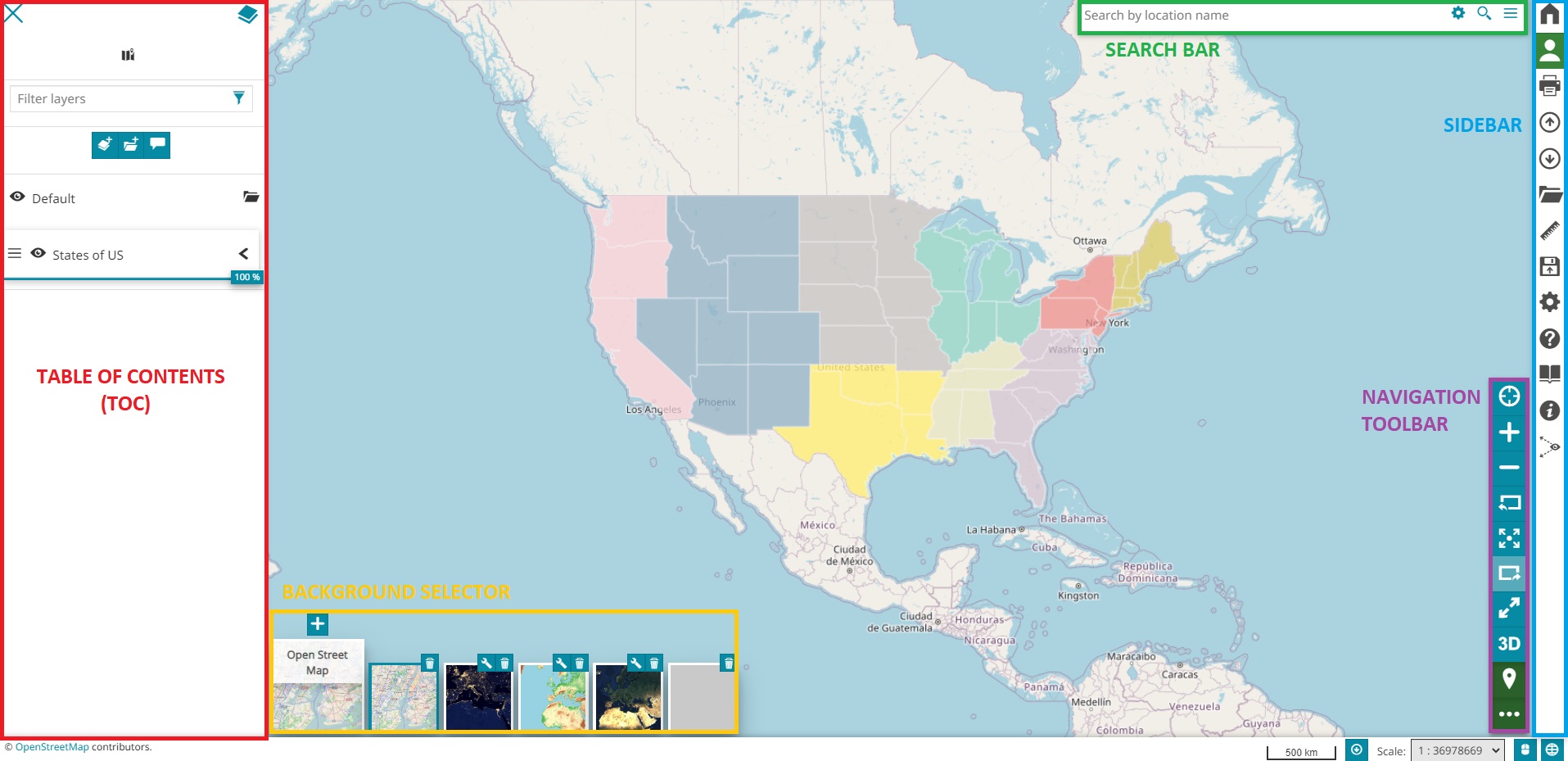
This is the main Map Viewer :

Map Viewer
The map viewer is composed of several tools, organized through the following sections:
The Map itself, at the center of the page, which the user can move and zoom to explore the data or click to retrieve information.
The Table of Contents (TOC) that shows the layers on the map, organized in groups, and allows to manage them. It can be expanded by clicking on the top-left button when you open the viewer.
The Search bar that allows to quick search locations on the map and configure the search options.
The Navigation Toolbar that contains the main tools for the navigation on the map, like the zooming, switching between 2D and 3D mode, going backward and forward in navigation history and so on…
Some Widgets that contains charts, tables counters and others to integrate the viewer with more info about your data.
The Background Selector that allows to switch or configure map backgrounds
The Footer that includes some additional information and tools (like credits, current scale, mouse position coordinates or current CRS selector )
The list of tools of the map viewer is in continuous evolution and we will open the MapStore User Guide for a complete overview of them. Here a list of the main ones:

Map Viewer Plugins & tools
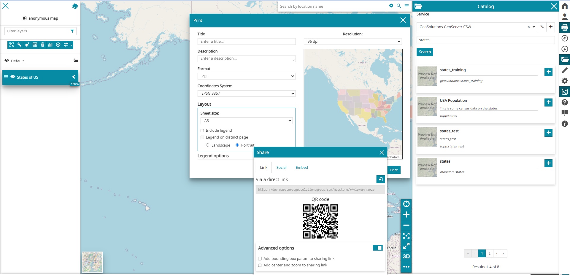
Catalog Tool: a tool aimed to handle many mapping services (WMS, WMTS, WFS, TMS, 3dTile …) and add layers on the map
Print tool, to print the current map in pdf, png or jpeg formats
Share tool, to get your resource’s link, embed your map or share on social networks

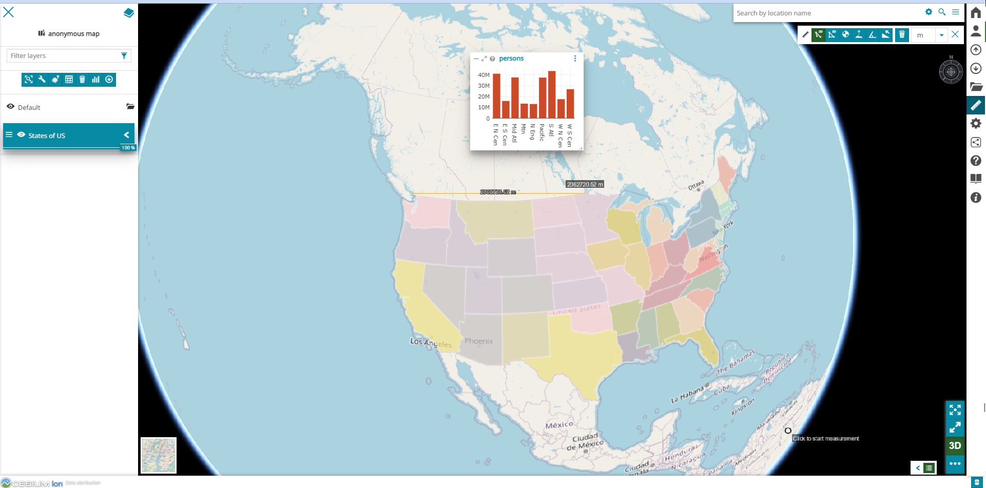
Map 3D Viewer with Cesium
Measure tool: to perform different kind of measurements (like distance, area and bearing etc.) on the map
Widget: to create widgets (such as such as charts, texts, tables and counters) for the layers added to the map.

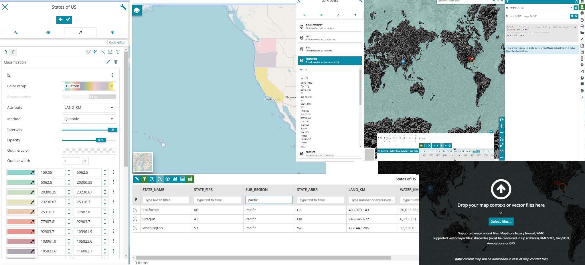
Collage of viewer tools
Visual Style Editor: to edit the layers style using a Visual editor UI
Attribute table: to show and manage tabular information related to vector layers.
Import/Export tool: to add map context files or vector files to a map or export a map.
And many many others as it is possible to consult in the MapStore online documentation.
