
Static Files Customizations Overview
This session aims to explore and overview the static files that allows customization of MapStore.
Note: we strongly advise to create a downstream project of MapStore to keep track of commit history and for a better maintainability even if the changes described in this session will allow a complete customization (MapStore Project topic covered in MS3)
Setup
download latest MapStore release from https://github.com/geosolutions-it/MapStore2/releases (files:
mapstore2-{version}-bin.zipandmapstore-printing.zip)extract all the content of
mapstore2-{version}-bin.zipand runmapstore2-startup.batormapstore2-startup.shbased on the OS in useMapStore will start a url
http://localhost:8082/mapstorestop the container using
mapstore2-shutdown.batormapstore2-shutdown.shbased on the OS in use- unzip the content of
mapstore-printing.zipand copy as described below content of
mapstore-printing/WEB-INF/classestomapstore2-{version}-bin/mapstore2/webapps/mapstore/WEB-INF/classescontent of
mapstore-printing/WEB-INF/libtomapstore2-{version}-bin/mapstore2/webapps/mapstore/WEB-INF/lib
- unzip the content of
run again the container with
mapstore2-startup.batormapstore2-startup.shbased on the OS in use
Now MapStore is running with the print plugin installed
HTML files
MapStore is a single page application that uses following html files:
index.hml: page used for the main viewer
embedded.html: display a map viewer used for embedded page
dashboard-embedded-template.html: display a dashboard viewer used for embedded page
geostory-embedded.html: display a geostory viewer used for embedded page
unsupportedBrowser.html: application redirects to this page if the browser is not supported
We will temporary edit the index.html to include a custom css file
Include a custom.css file
create a new folder called assets inside
mapstore2-{version}-bin/mapstore2/webapps/mapstore/directorycreate a new file called
custom.cssinsidemapstore2-{version}-bin/mapstore2/webapps/mapstore/assets/css/custom.csswith the following content
/*
test to verify the correct import of custom.css
main navbar should become dark
*/
#ms-brand-navbar {
    background-color: #333333;
}
open the
mapstore2-{version}-bin/mapstore2/webapps/mapstore/index.htmlfile and add the following stylesheet
<head>
    ...
+    <link rel="stylesheet" href="assets/css/custom.css" />
</head>
reload the MapStore page and verify if the navbar changed color. If so the custom.css is ready to be used for theme customization
Make a new theme with css variables
MapStore theme is using CSS variables so it is possible to override them by creating a new selector that declare new colors per variable. Steps to overrides theme colors:
replace the content of
custom.cssfile with:
:root {
    --ms-main-bg: #333333;
    --ms-main-color: #f2f2f2;
}
reload the mapstore application. Now the background will use the new dark color with a contrast white text.
This customization is not complete yet because there are still some missing some variables: primary, success, main variant, link color, … .
Here a tool that helps to generates a css snippet with all the theme variables based on a set of input colors. After applied your favorite colors copy the generated style in the custom.css file.
Jumbotron image
Jumbotron image in the homepage is currently provided as a css background image so it’s possible override it using the same selector with a different image. We suggest to use an image that fit the width and height of the jumbotron to minimize the size of the file (eg: 1920px x 300px)
create an img folder inside the assets one
save the below image in “assets/img/jumbotron.jpg” or copy the following one
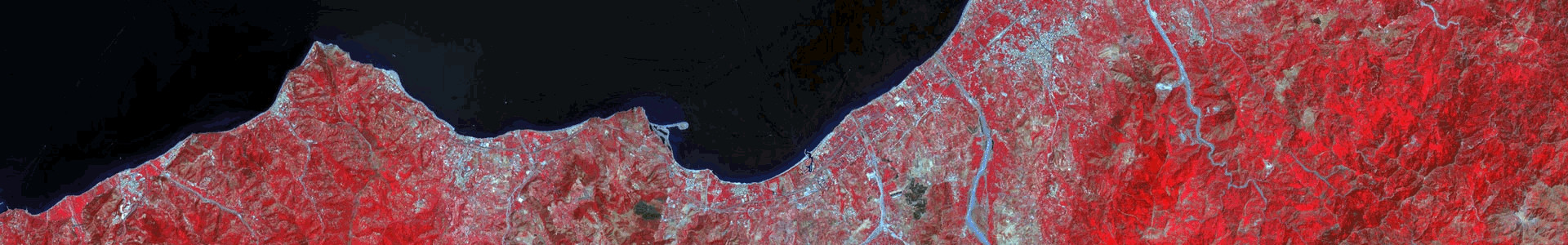
original image source https://unsplash.com/photos/ZvLvu1gUcYA
edit
mapstore2-{version}-bin/mapstore2/webapps/mapstore/configs/localConfig.jsonHomeDescription plugin with the following rule to customize header
{
    "name": "HomeDescription",
    "cfg": {
      "backgroundSrc": "assets/img/jumbotron.jpg"
    }
  }
Remove plugins via localConfig.json
The mapstore2-{version}-bin/mapstore2/webapps/mapstore/configs/localConfig.json is the main configuration used by MapStore to manage different options including the structure of plugins in the different pages. We need to remove some default plugins from the homepage, here the steps:
open the localConfig.json file inside the
mapstore2-{version}-bin/mapstore2/webapps/mapstore/configs/folderremove
{ "name": "Footer" },from the plugins.maps list of plugins (restore it afterwards)
Now the “Footer” will no longer appear in the homepage. Eventually you can edit other existing plugins
Logo
The logo can be updated by changing a configuration in localConfig.json.
copy this file and copy it inside the
mapstore2-{version}-bin/mapstore2/webapps/mapstore/assets/imgfolder
edit all the instance of “BrandNavbar” plugin inside the
mapstore2-{version}-bin/mapstore2/webapps/mapstore/configs/localConfig.jsonfile with the new configuration for the header logo
{
    "name": "BrandNavbar",
    "cfg": {
        "logo": {
        "src": "assets/img/logo.svg",
        "href": "/my-link"
        }
    }
}
edit all the instance of “Footer” plugin inside the
mapstore2-{version}-bin/mapstore2/webapps/mapstore/configs/localConfig.jsonfile with the new configuration for the footer logo
{
    "name": "Footer",
    "cfg": {
        "menuItems": [{
            "src": "assets/img/logo.svg",
            "type": "logo",
            "href": "/my-link",
            "target": "blank",
            "style": {}
        }]
    }
},
Locales
edit “locales” section inside the
mapstore2-{version}-bin/mapstore2/webapps/mapstore/configs/localConfig.jsonfile with the new list of supported locales
"locales": {
    "supportedLocales": {
        "it": {
            "code": "it-IT",
            "description": "Italiano"
        },
        "en": {
            "code": "en-US",
            "description": "English"
        }
    }
}
Translations
create a new folder called translations inside the assets folder (
mapstore2-{version}-bin/mapstore2/webapps/mapstore/assets/translations)create a new file for the english translations overrides with the following content (
mapstore2-{version}-bin/mapstore2/webapps/mapstore/assets/translations/data.en-US.json)
{
    "locale": "en-US",
    "messages": {
        "home": {
            "shortDescription": "<h1>Title of MapStore</h1><p>subtitle</p>",
            "footerDescription": "MapStore Training"
        }
    }
}
create a new file for the italian translations overrides with the following content (
mapstore2-{version}-bin/mapstore2/webapps/mapstore/assets/translations/data.it-IT.json)
{
    "locale": "it-IT",
    "messages": {
        "home": {
            "shortDescription": "<h1>Il mio GeoPortale MapStore personalizzato</h1><p>sottotitolo</p>",
            "footerDescription": "MapStore Training"
        }
    }
}
add “translationsPath” property inside the
mapstore2-{version}-bin/mapstore2/webapps/mapstore/configs/localConfig.jsonfile including new translations path
"translationsPath": [ "translations", "assets/translations" ],
Context themes
create a new theme called
new-theme.cssinsidemapstore2-{version}-bin/mapstore2/webapps/mapstore/assets/cssusing the theme tooladd “themes” configuration to “ContextCreator” plugin inside the
mapstore2-{version}-bin/mapstore2/webapps/mapstore/configs/localConfig.jsonfile
{
    "name": "ContextCreator",
    "cfg": {
        ...
        "themes": [
            {
                "id": "new-theme",
                "type": "link",
                "href": "assets/css/new-theme.css",
                "defaultVariables": {
                    "ms-main-color": "#000000",
                    "ms-main-bg": "#FFFFFF",
                    "ms-primary-contrast": "#FFFFFF",
                    "ms-primary": "#078aa3",
                    "ms-success-contrast": "#FFFFFF",
                    "ms-success": "#398439"
                }
            }
        ],
        "basicVariables": {
            "ms-main-color": "#000000",
            "ms-main-bg": "#FFFFFF",
            "ms-primary-contrast": "#FFFFFF",
            "ms-primary": "#078aa3",
            "ms-success-contrast": "#FFFFFF",
            "ms-success": "#398439"
        }
    }
},
Printing configuration
replace the layout header by replacing the
mapstore2-{version}-bin/mapstore2/webapps/mapstore/printing/print_header.pngwith the following image

replace the north arrow by replacing the
mapstore2-{version}-bin/mapstore2/webapps/mapstore/printing/Arrow_North_CFCF.svgwith the following image
other additional configuration on the layouts are available at https://mapfish.github.io/mapfish-print-doc/attributes.html
New map configuration
replace initial “center” position for new map in the
mapstore2-{version}-bin/mapstore2/webapps/mapstore/configs/new.jsonfile
"center": {
    "x": 11.2558136,
    "y": 43.7695604,
    "crs": "EPSG:4326"
},
replace initial “zoom” level for new map in the
mapstore2-{version}-bin/mapstore2/webapps/mapstore/configs/new.jsonfile
"zoom": 7,
replace initial base map “layers” for new map in the
mapstore2-{version}-bin/mapstore2/webapps/mapstore/configs/new.jsonfile
"layers": [
    {
        "type": "osm",
        "title": "Open Street Map",
        "name": "mapnik",
        "source": "osm",
        "group": "background",
        "visibility": true
    },
    {
        "source": "ol",
        "group": "background",
        "title": "Empty Background",
        "fixed": true,
        "type": "empty",
        "visibility": false,
        "args": [
            "Empty Background",
            {
            "visibility": false
            }
        ]
    }
]
add a specific set of scales for new map in the
mapstore2-{version}-bin/mapstore2/webapps/mapstore/configs/new.jsonfile
"mapOptions": {
    "view": {
        "scales": [175000, 125000, 100000, 75000, 50000, 25000, 10000, 5000, 2500]
    }
},
add a extent constraint for all the map in the
mapstore2-{version}-bin/mapstore2/webapps/mapstore/configs/localConfig.jsonfile
"mapConstraints": {
    "crs": "EPSG:4326",
    "restrictedExtent": [ 6.62, 37.86, 18.58, 47.1 ]
},
New GeoStory configuration
replace default geostory initial theme with a custom by editing
mapstore2-{version}-bin/mapstore2/webapps/mapstore/configs/newgeostory.jsonfile
"settings": {
    "theme": {
        "general": {
            "color": "#ffffff",
            "backgroundColor": "#333333",
            "borderColor": "#777777"
        },
        "overlay": {
            "backgroundColor": "rgba(0, 0, 0, 0.75)",
            "borderColor": "#777777",
            "boxShadow": "0 14px 28px rgba(0,0,0,0.25), 0 10px 10px rgba(0,0,0,0.22)",
            "color": "#ffffff"
        }
    }
},
Catalog Configuration
replace the default Catalog services by editing the
mapstore2-{version}-bin/mapstore2/webapps/mapstore/configs/localConfig.jsonfile for global and DashboardEditor configurations
"selectedService": "local_wms",
"services": {
    "local_wms": {
        "url": "http://localhost:8080/geoserver/wms",
        "type": "wms",
        "title": "Local GeoServer WMS",
        "autoload": true
    }
},
if needed add the new catalog url to the useCORS list to ensure the client send direct request the service. This configuration is inside the
mapstore2-{version}-bin/mapstore2/webapps/mapstore/configs/localConfig.jsonfile
"proxyUrl": {
    "url": "proxy/?url=",
    "useCORS": [
        ...other urls,
        "http://localhost:8080/geoserver/wms"
    ]
},
Map projections
MapStore allows to add new projection that can be used in the OpenLayers map viewer. The def property of the projection should be described as a proj4js definition
add this configuration inside the
mapstore2-{version}-bin/mapstore2/webapps/mapstore/configs/localConfig.jsonfile to include the EPSG:3003 and EPSG:3004 projection
"projectionDefs": [
    {
        "code": "EPSG:3003",
        "def": "+proj=tmerc +lat_0=0 +lon_0=9 +k=0.9996 +x_0=1500000 +y_0=0 +ellps=intl +towgs84=-104.1,-49.1,-9.9,0.971,-2.917,0.714,-11.68 +units=m +no_defs",
        "extent": [1241482.0019, 973563.1609, 1830078.9331, 5215189.0853],
        "worldExtent": [6.6500, 8.8000, 12.0000, 47.0500]
    },
    {
        "code": "EPSG:3004",
        "def": "+proj=tmerc +lat_0=0 +lon_0=15 +k=0.9996 +x_0=2520000 +y_0=0 +ellps=intl +towgs84=-104.1,-49.1,-9.9,0.971,-2.917,0.714,-11.68 +units=m +no_defs",
        "extent": [1782205.39, 4223533.54, 2791665.11, 5222517.32],
        "worldExtent": [6.62, 37.86, 18.58, 47.1]
    }
],
add new crs to the list of the available ones to the CRSSelector plugin inside the
mapstore2-{version}-bin/mapstore2/webapps/mapstore/configs/localConfig.json
"additionalCRS": {
    "EPSG:3003": {
        "label": "EPSG:3003"
    },
    "EPSG:3004": {
        "label": "EPSG:3004"
    }
}
Note: projection definition could be retrieved at https://epsg.io/
3D Terrain
MapStore allows to configure a custom terrain provider that could be provided as wms layer from GeoServer in the application/bil16.
setup a layer in GeoServer that support application/bil16 format by using the DSS/BIL plugin (see https://mapstore.readthedocs.io/en/latest/developer-guide/maps-configuration/#special-case-the-elevation-layer)
add following configuration to the Map plugin using the url and name for the terrain layer previously configured in GeoServer by editing the
mapstore2-{version}-bin/mapstore2/webapps/mapstore/configs/localConfig.jsonfile
"additionalLayers": [
    {
        "url": "http://localhost:8080/geoserver/wms",
        "type": "wms",
        "format": "application/bil16",
        "name": "etopo:ETOPO1",
        "littleendian": false,
        "visibility": true,
        "useForElevation": true
    }
],
Annotation Symbols
clean up of the svg icon remove style inside the file svg
copy the logo.svg file inside the
mapstore2-{version}-bin/mapstore2/webapps/mapstore/product/assets/symbolsfolderedit the
mapstore2-{version}-bin/mapstore2/webapps/mapstore/product/assets/symbols/symbols.jsonfile to include only the following icons
[
    {"name": "triangle", "label": "Triangle"},
    {"name": "logo", "label": "Logo"}
]
Note: ensure the the new svg symbol does not contain inline style to allow the annotation editor to apply custom colors
Conclusion
We covered the most common customization and configuration available via static files in MapStore. The following documentation provides additional configuration that could be applied to the app or to single plugins:
Developer guide https://mapstore2.readthedocs.io/en/user_docs/developer-guide/
Plugin available configuration https://mapstore.geosolutionsgroup.com/mapstore/docs/api/plugins
We advise to copy all the changed file in a MapStore project or in a separate repository to avoid an override in the next mapstore.war update.